Typical techniques for determining the extent and magnitude of point and non-point source pollution problems include long-term surface water monitoring and computer-based simulation. Due to the time and expense associated with surface water monitoring, however, computer simulations have been relied upon more frequently to provide needed information for the development and implementation of point and non-point source control programs. A numerical model is conceived as a system for supporting the development of Total Maximum Daily Loads (TMDLs). Developing TMDLs requires a watershed-based approach that integrates both point and non-point sources. An assessment of point and non-point sources is a multipurpose environmental analysis system for use by national, provincial, regional and local authorities/agencies in performing watershed and water quality studies.
Watershed and water quality models are commonly considered an essential tool for evaluating the sources and controls of sediment, nutrient and pathogen loading to surface waters. Such models provide a framework for integrating the data that describe the processes and land-surface characteristics that determine pollutant loads transported to nearby water bodies. The utilization of watershed models, however, is a difficult, tedious task because of the broad spatial and temporal scales that must be considered, as well as the large amount of data that must be compiled, integrated, analyzed and interpreted. GIS (Geographic Information System) technology provides the means for processing, and presenting spatially-referenced model input and output data. Through the use of GIS, the numerical model has the flexibility to display and integrate a wide range of information (e.g., land use, point source discharges, water supply and withdrawals) at a scale chosen by the user. The model will be working under the GIS umbrella, allows users to quickly evaluate selected areas, organize information, and display results.
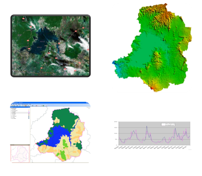
The numerical tool will take advantage of recent developments in open source software, data management technologies, and computer capabilities to provide the user with a fully comprehensive watershed management tool. The model is designed to facilitate scenarios of Climate Change. The model developed in this study, namely the SNU-WS (Seoul National University WaterShed Simulation) Tool, is a combined hydrologic runoff and river routing model. The model contains three main parts immerged into the open source MapWindow GIS software (www.mapwindow.org) as plugins; the first part is a pre-processing tool; the second part is the runoff calculation tool based on the theory of Generalized Watershed Loading Functions (GWLF) with a number of modifications and enhancements on runoff, sediment yields and daily time step output; and the last part is a routing model engaged with the well-known HEC-RAS model. The model is programming in VB.NET, and designed to complement and interoperate with enterprise and full-featured under MapWindow GIS functions.
An Application for Tri An Region in Vietnam